Water Today: A Taxonomy
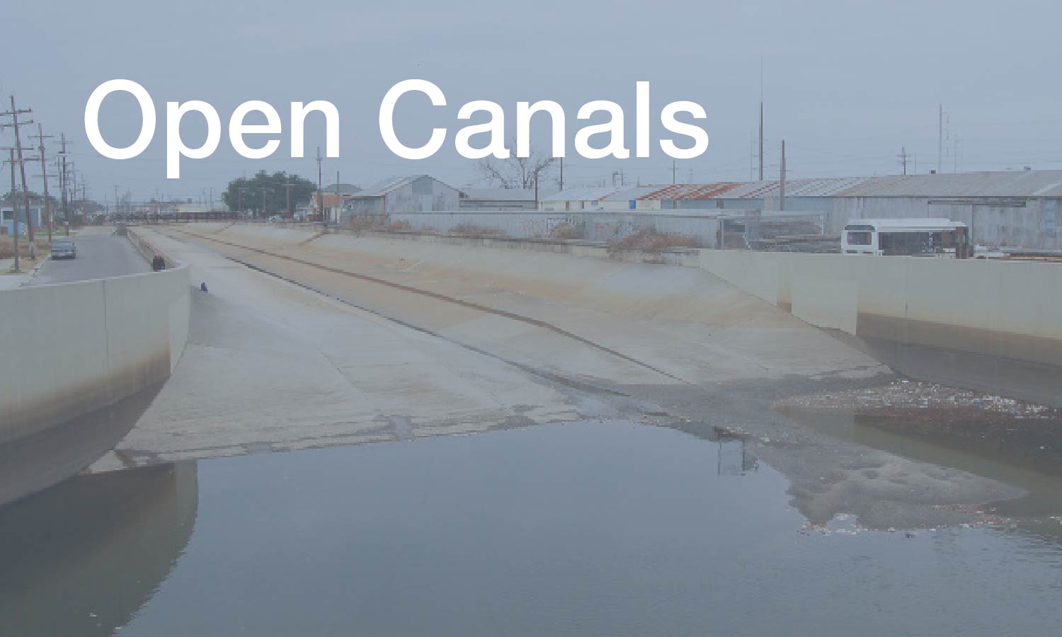
Underground Drainage | Open Canals | Navigation Channels | Surface Patterns and Subsurface Conditions
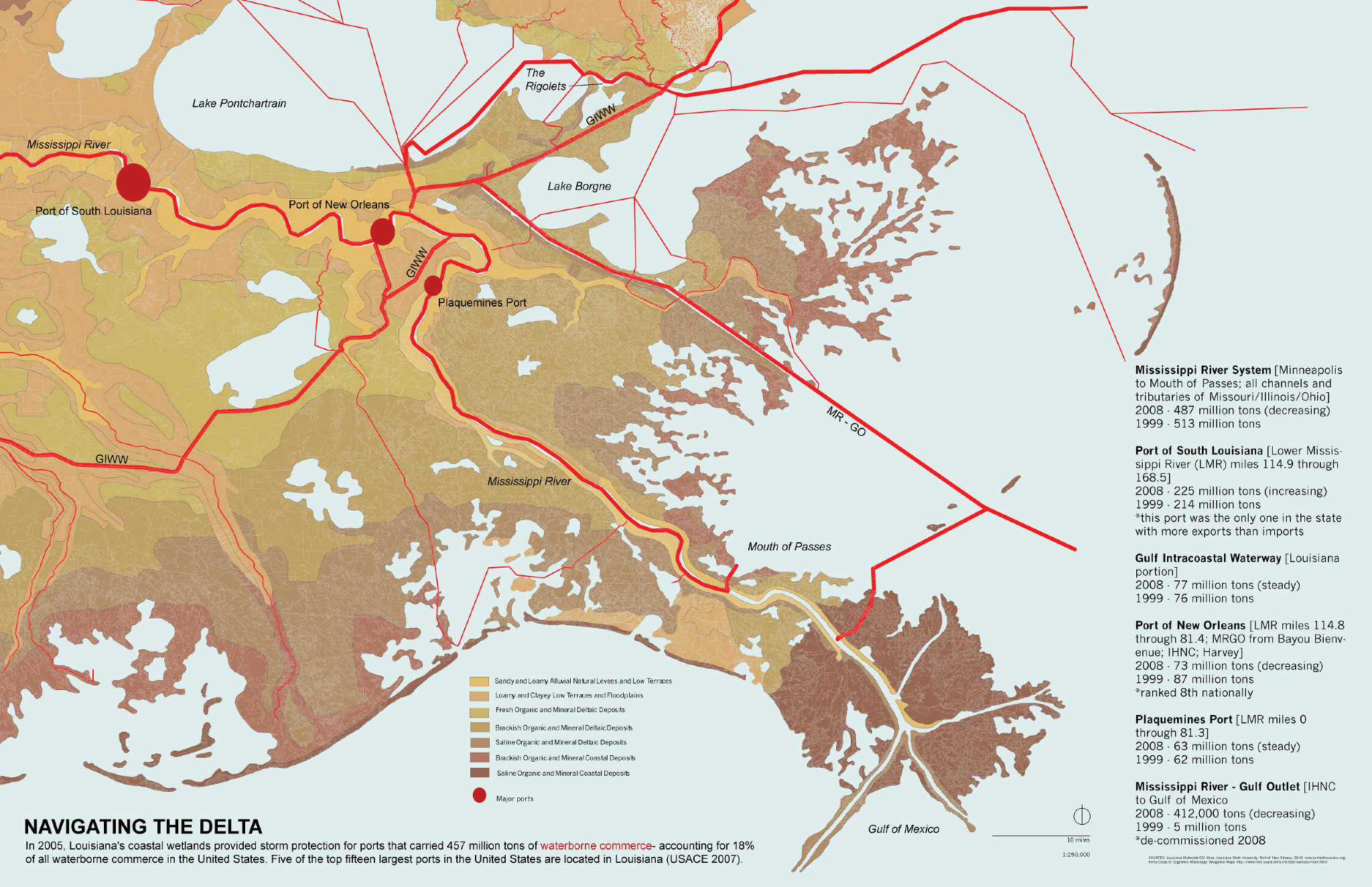
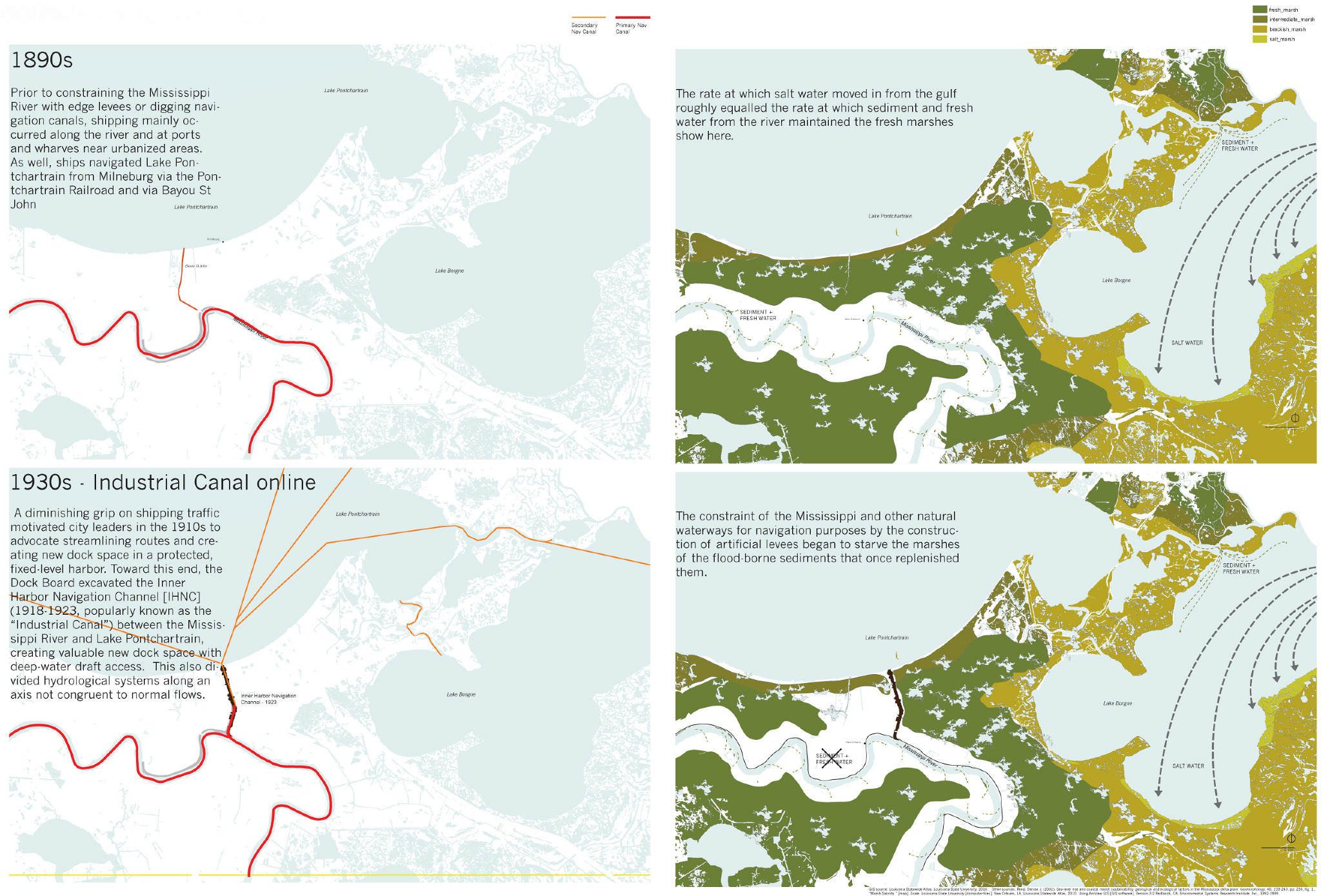
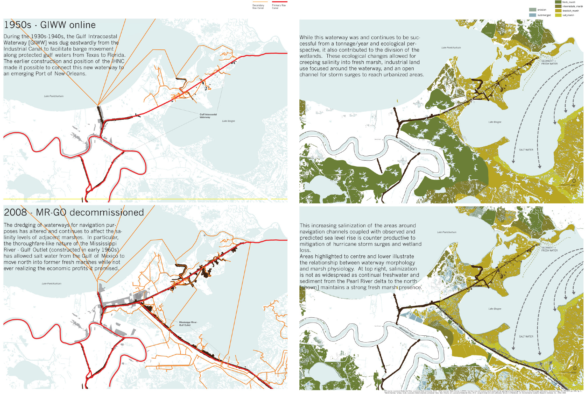
Navigation Channels

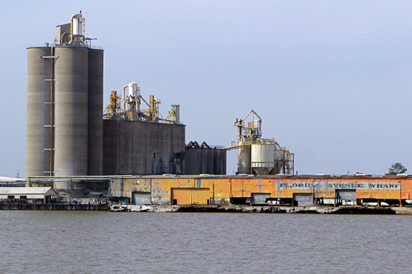
Navigation channels are not part of the drainage system of New Orleans. However, they have an indirect but powerful effect on the city’s vulnerability to flooding: they have been major contributors to regional wetlands loss, which increases the risk of inundation in New Orleans.
The navigation channels were dug as part of a web of transport infrastructure, and they connect water systems to other urban and regional networks. However, the extensive system of canals built across southern Louisiana has exacerbated erosion by lengthening the interface between wetlands and open water. They also provide avenues for saltwater migration and for storm surges.
In recent decades, the canals have fallen out of use, and their future is in question: in 2008, the Mississippi River Gulf Outlet (MR-GO) was closed just below New Orleans to reduce the city’s flood risk.
Drawing Credits
Justin Miron, Nicole Napoleone and Todd Smith. Gutter to Gulf Studio 2010. John H. Daniels Faculty of Architecture, Landscape and Design, University of Toronto.
Drawing Citations ︎︎︎


[back to Water Today]

Underground
Drainage

Open Canals

Navigation Channels

Subsurface Conditions and Surface Patterns