 Photo credit: Gutter to Gulf Studio 2010.
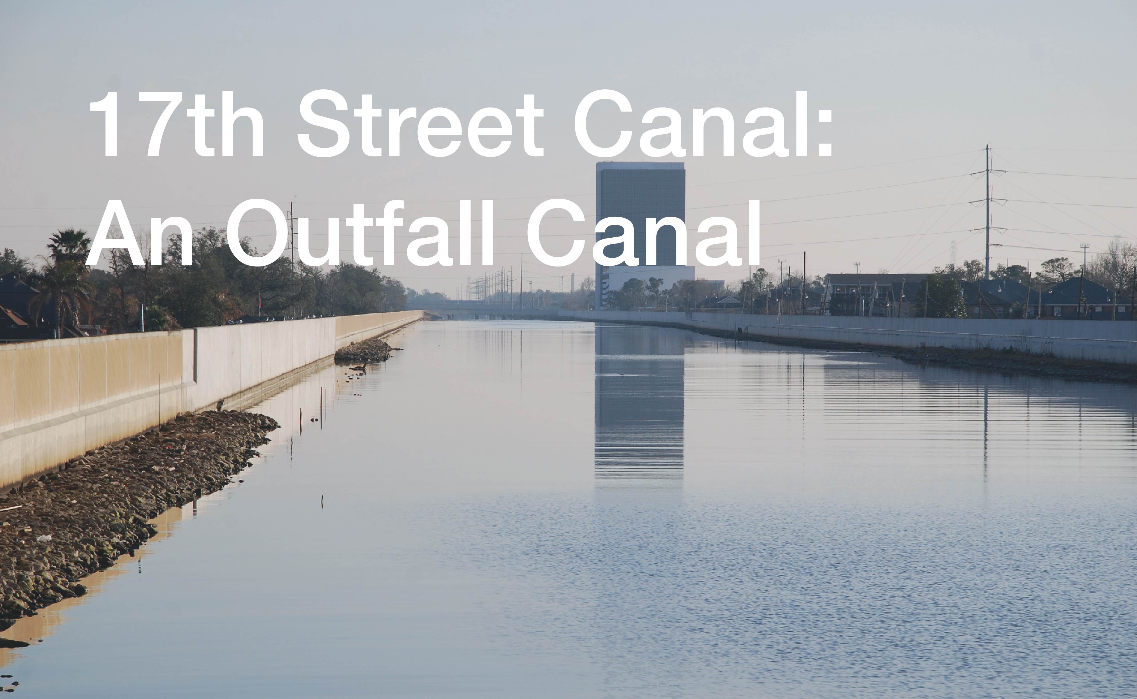
The 17th Street Canal is a constructed waterway. Originally dug during the construction of a rail line that connected the Mississippi River to Lake Pontchartrain, it has become the largest single outlet for New Orleans’s drainage system. Subsidence has created the need for high levee walls along the canal’s entire length: the water it carries is significantly higher than the land it crosses. The levee walls were breached during Hurricane Katrina. Since then, booster pumps have been added where the canal meets Lake Pontchartrain to reduce the risk of future failures.
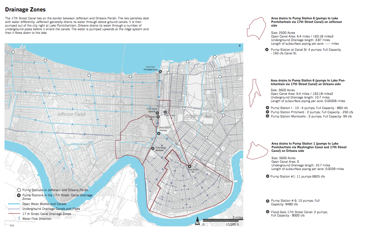
The 17th Street Canal is a jurisdictional boundary: it divides Orleans Parish from Jefferson Parish. Each parish has a different way of managing water. In Orleans Parish, water is pumped up to the level of Lake Pontchartrain while it is still inside the city. In Jefferson Parish, water remains at grade until it reaches the lake.


Drawings by Jenny Bukovec, Annie Idris, Greg Warren and Lu Zhang. Gutter to Gulf Studio 2010. John H. Daniels Faculty of Architecture, Landscape and Design. University of Toronto.
Drawing Citations ︎︎︎