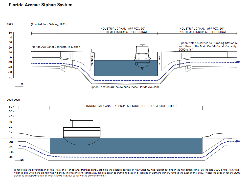
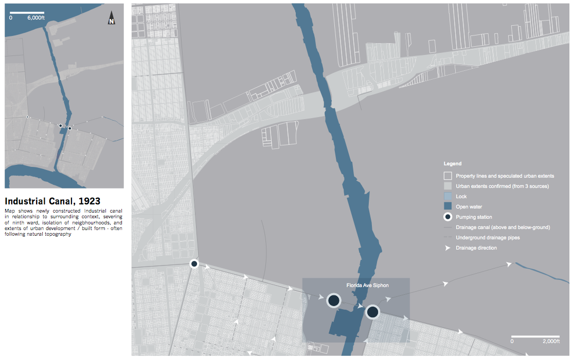
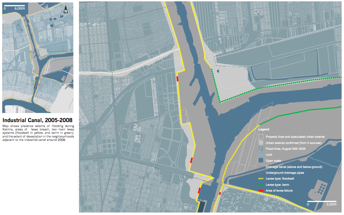
Industrial Canal: A Navigation Channel
The Industrial Canal was excavated in 1923 to permit large ships to travel between the Mississippi River and Lake Pontchartrain. Part of a navigation network that also included the Mississippi River Gulf Outlet and the Inter-Coastal Waterway, the Industrial Canal has become obsolete: its locks are too small to accommodate today’s seagoing vessels.
The canal’s disruption made an arbitrary division in the cypress swamps between the Mississippi and Lake Pontchartrain. It continues to disrupt the flow of water and people from the central part of New Orleans (Drainage Basin One), and the Lower Ninth Ward and New Orleans East. It has become a significant flood hazard because the land on either side has subsided since its construction.
Drawings by Karen May, Justin Miron and Todd Smith. Gutter to Gulf Studio 2010. John H. Daniels Faculty of Architecture, Landscape and Design. University of Toronto.
Drawing Citations ︎︎︎